Provincial News

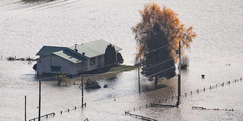
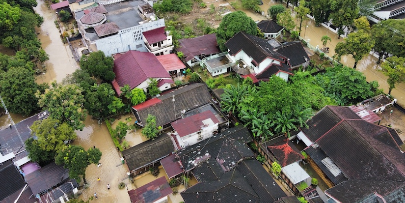
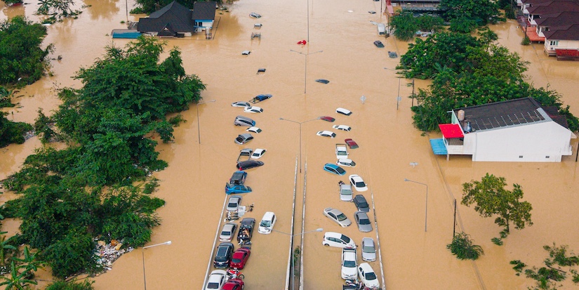
In this photograph taken with a drone; a large amount of water floods a low area of a farm near a house in Abbotsford, B.C., Wednesday, Jan. 31, 2024. A weather system with unseasonable warmth has melted snow and brought drenching rain to the province with temperatures reaching 18C in parts of B.C.'s Lower Mainland this week.
THE CANADIAN PRESS/Darryl Dyck
Why is B.C. facing the prospect of a flood disaster again?
Published 12:25 PST, Thu December 11, 2025
Last Updated: 2:02 PST, Thu December 11, 2025


-
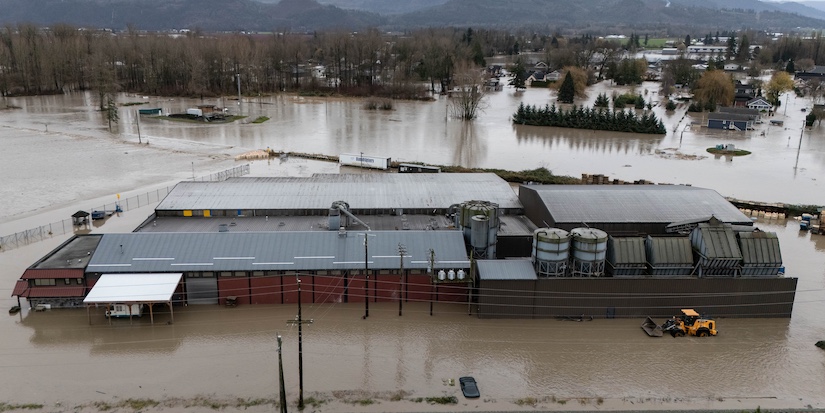
British Columbia's Lower Mainland is facing flooding, severed highways and evacuations due to the double impact of an atmospheric river and cross-border water flows. Here's an explainer of why the area has been repeatedly hit by similar disasters.
WHAT IS AN ATMOSPHERIC RIVER?
A long, thin, horizontal "corridor" of water vapour typically associated with a low-level jet stream ahead of the cold front of a cyclonic storm outside the tropics. Atmospheric rivers are associated with heavy precipitation in places where they are forced upwards and they transport more water than double the flow of the Amazon River, on average. They transport heat and moisture from the tropics north, giving them the nickname "pineapple express."
Environment Canada says about 30 to 40 atmospheric rivers hit coastal B.C. every year. Normally, that's a good thing, since they replenish snowpacks and water supply. But if they are particularly strong, long-lasting, or occur repeatedly, their impacts can be disastrous, linked to major flooding in 2021, then again in January and October 2024.
"It kind of is what the name sounds like," says Elise Legarth, a PhD candidate at University of British Columbia's Department of Earth, Ocean and Atmospheric Sciences. "If you're looking at a weather map, it looks like this kind of river of extreme water vapour that's transient.
"Atmospheric rivers are very common … It's only these that fall in the really high end that's impactful, that we see the results of flooding and everything, and they are few and far between."
WHAT HAPPENED THIS WEEK?
An atmospheric river brought heavy rainfall to southern B.C., with up to 145 millimetres of rain being recorded in parts of the Fraser Valley from Wednesday to 4 a.m. Thursday. The rain has since tapered off in B.C. But the storm also pummelled Washington state, which has declared a state of emergency, with the Nooksack River breaking its banks on Wednesday.
Environment Canada meteorologist Jennifer Smith says the high amount of rainfall within a short a mount of time is among the reasons an atmospheric river can have major flood impacts, but this year's version is likely to be less severe than 2021.
"A lot of the region has been dry through much of the fall season, so it does still have some capacity to absorb some of the moisture unlike previous events," Smith says, noting the 2021 atmospheric river came on the heels of successive rainfalls that left the ground already saturated.
WHY DOES THE NOOKSACK RIVER MATTER TO B. C.?
When the Nooksack overflows, there's a chance its waters will spread to British Columbia, which happened in 1990 and in 2021, causing extensive destruction. Four years ago, the Nooksack's waters flooded the low-lying Sumas Prairie in Abbotsford, causing billions worth of damage and devastating livestock.
Emergency officials have said that outflows from the Nooksack overnight on Wednesday rivalled those of 2021, and waters from the river began pouring across the border on Thursday.
"The event of yesterday, most of the intense precipitation associated with it actually fell just on the other side of the border in Washington State," says Madalina Surcel, climate extremes specialist with Environment Canada. This made it challenging for Canadian forecasters to analyze and determine if an extreme event was happening.
HOW IS THE NOOKSACK OVERFLOW RISK HANDLED?
An extensive dike system and the Barrowtown pump station in Abbotsford protects the Sumas Prairie. The station pumps water out of the low-lying lands into the Fraser River via the Sumas Canal. But it was almost overwhelmed in 2021. The provincial government has since been upgrading the facility, constructing protective walls and improving the machinery, but this work is not yet complete.
"One of the key things is the building of flood-resilient infrastructure," Legarth says. "So redoing our floodplain maps, redoing all of the science to make sure that climate change effects are incorporated in the design of our roads, planning our bridges, our dams so that when these events happen, our infrastructure can cope with it better.
"When a lot of this infrastructure was first designed, we weren't so aware of the impacts of climate change and the severity of these events. And so actually, there might need to be some updates to the infrastructure so it can accommodate these more severe events."
-- With files from Chuck Chiang in Vancouver and Jordan Omstead in Toronto
This report by The Canadian Press was first published Dec. 11, 2025.


2 Hours of free financial consulting
Jai Xin Planning Ltd.
C$120.00 C$0.00

Use any of our home staging service and get a second month rental for free!
MiiX Interiors
C$500.00 C$0.00

Get 10% off any order
Phantom Screens Lower Mainland
C$200.00 C$180.00